The thing that everyone does when they go to Kotor (and which is a great thing to do) is climb up the many steps to the fortress that sits above the town.
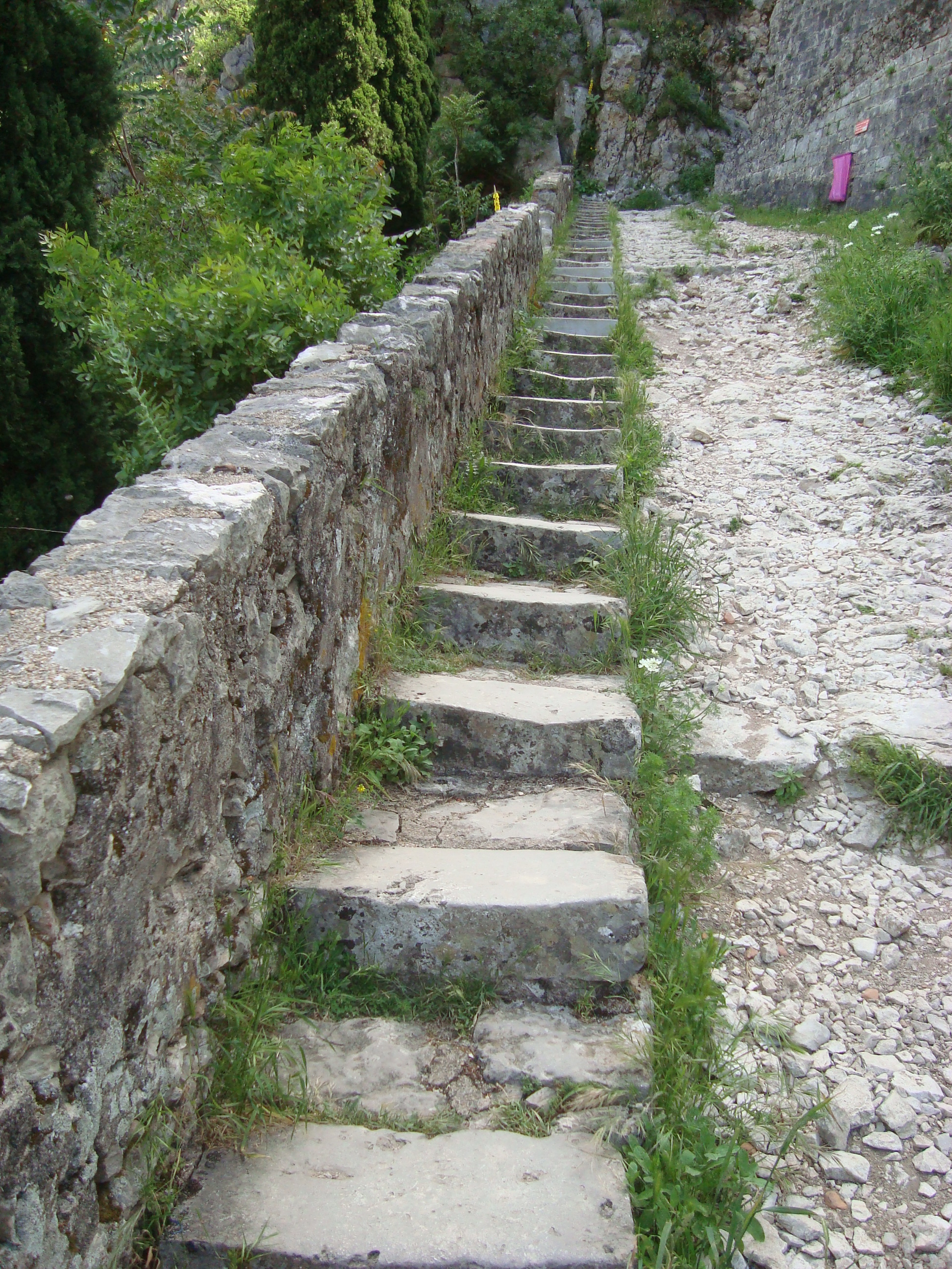
For a tourist destination, the path is refershingly clear of cigarette butts and coke cans and all the other junk. I put this down to the pink bin bags that can be found at intervals on the way up (you can see one in the photo above).
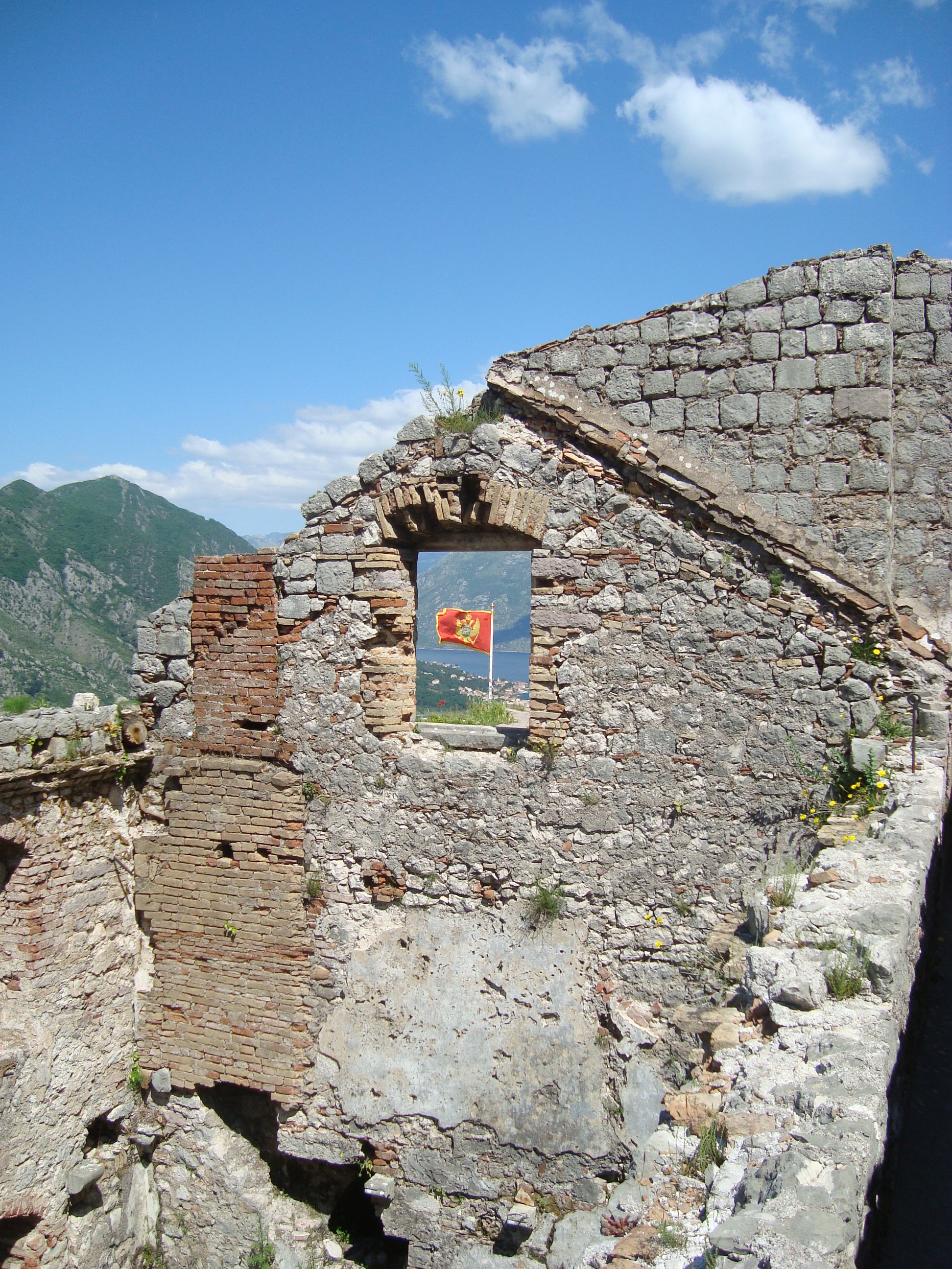
Once you get there it’s an interesting place to poke around and a spectacular view of the town.
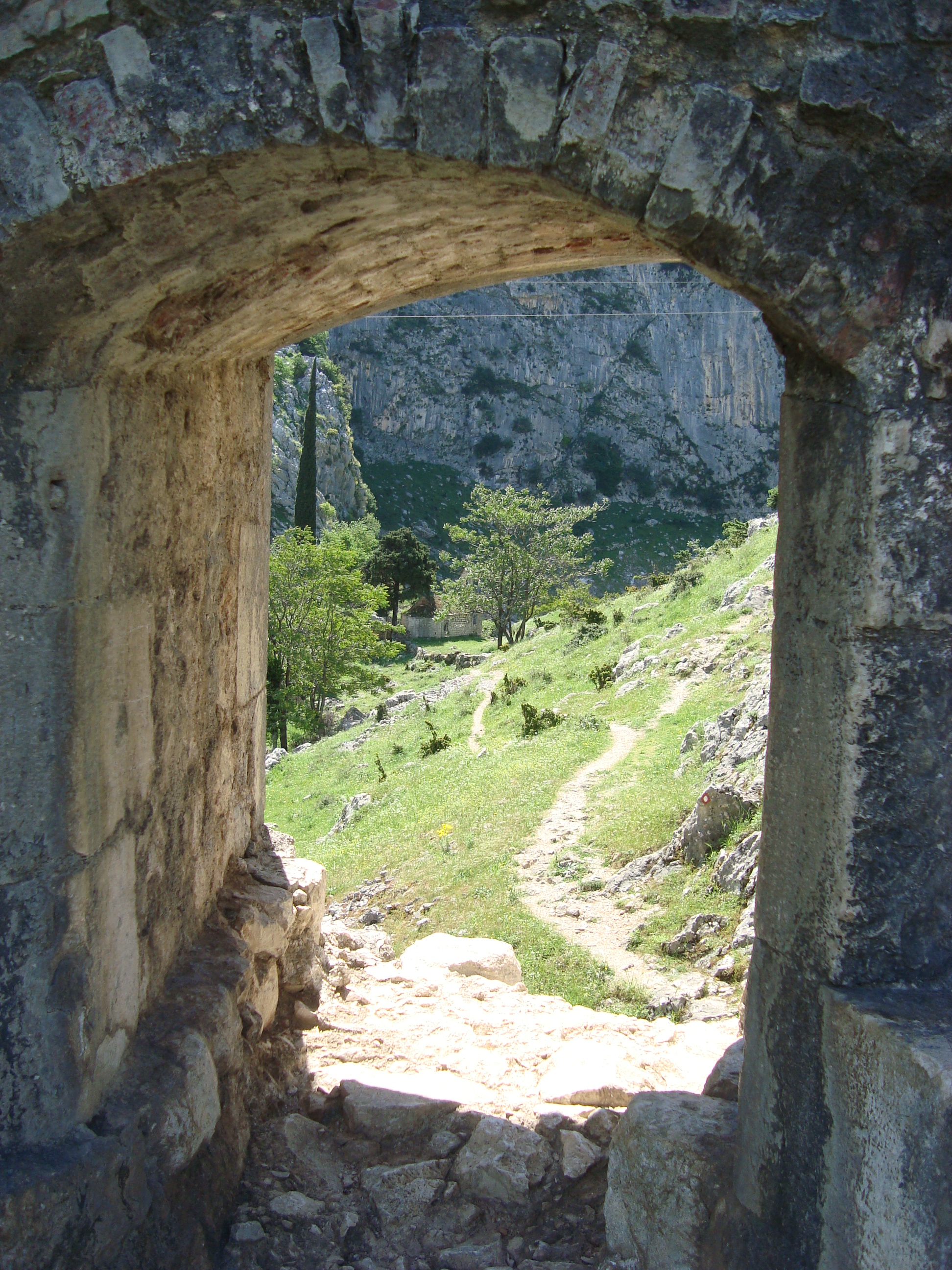
Another thing you can do, which not so many people do do, is climb out through a hole in the fortress wall and start your way hiking up the rest of the fjord mountains.
At intervals, on the way up to the fortress, some plateaus fan off to the left hand side of the path, and it is the second of these from the top that contains the hole in the wall. This leads out to a goat track and down to a little old chapel:
The chapel is pretty and deserted and its ceiling is coloured in the same, if peeling, blue paint with yellow stars which you might have noticed on the ceiling of the more frequented Church of Our Lady of Remedy which is located on the main path to the fortress.
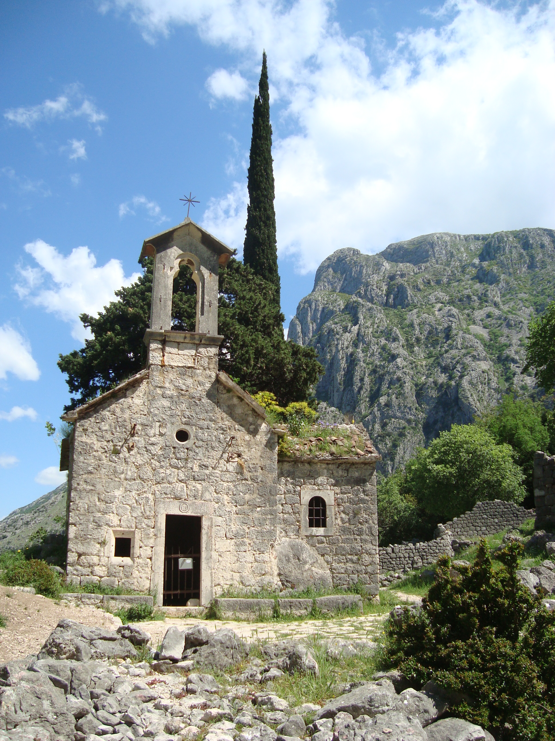
Even if you are just going this far, it is worth the detour as the area is quite wild and scenic, however, heading on from the chapel, you’ll pass a small house which it turns out is also a rakija bar!!!!
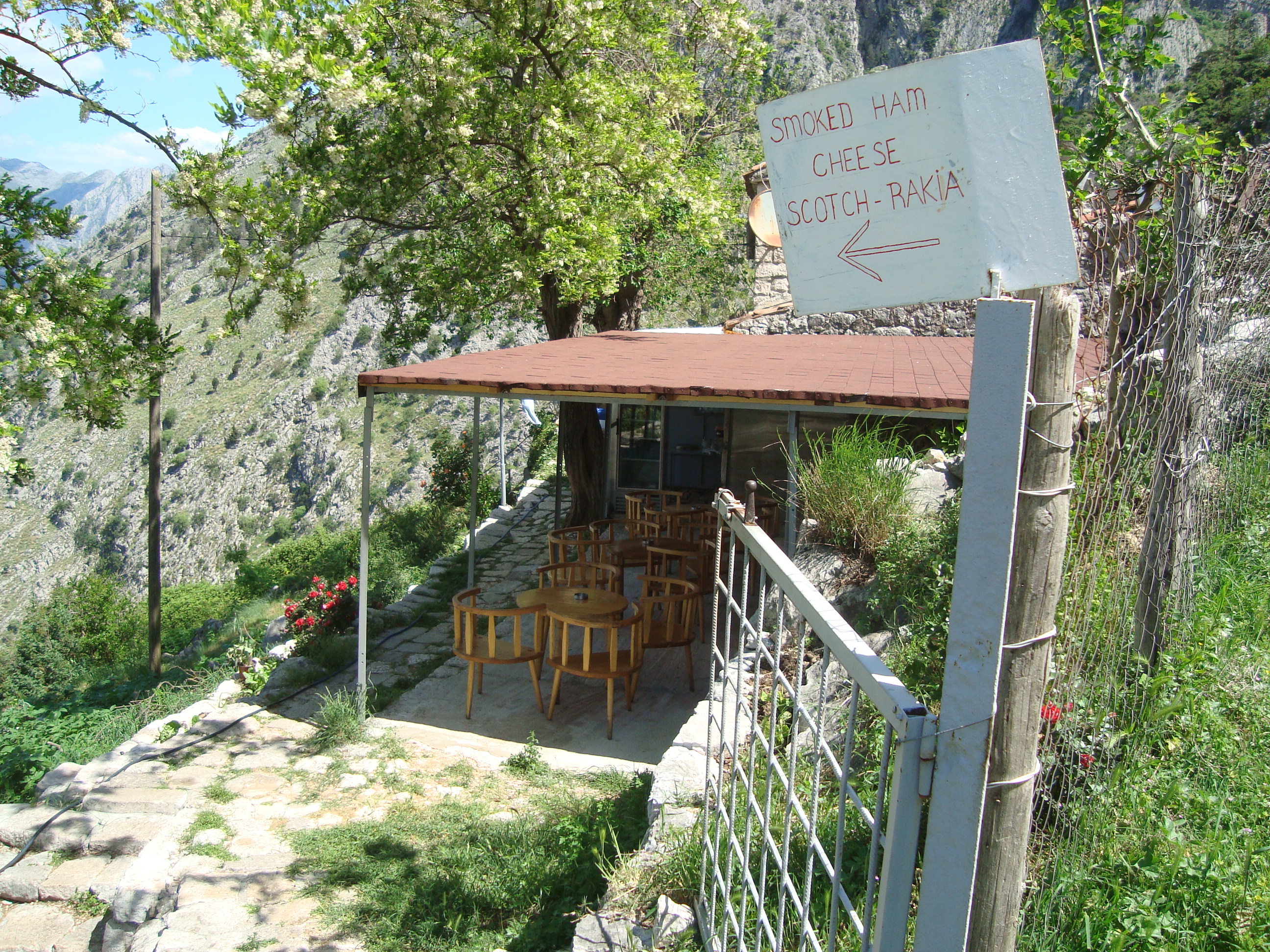
I thought I might try this place out on the way back down the hill (well let’s face it, I considered popping in straight away, but it was hot and I had a long way to go). In fact a lady came out and asked me if I wanted something but I used my Will of Steel in order to decline politely and continue on.
After the lady’s rakija bar there was the lady’s dog:
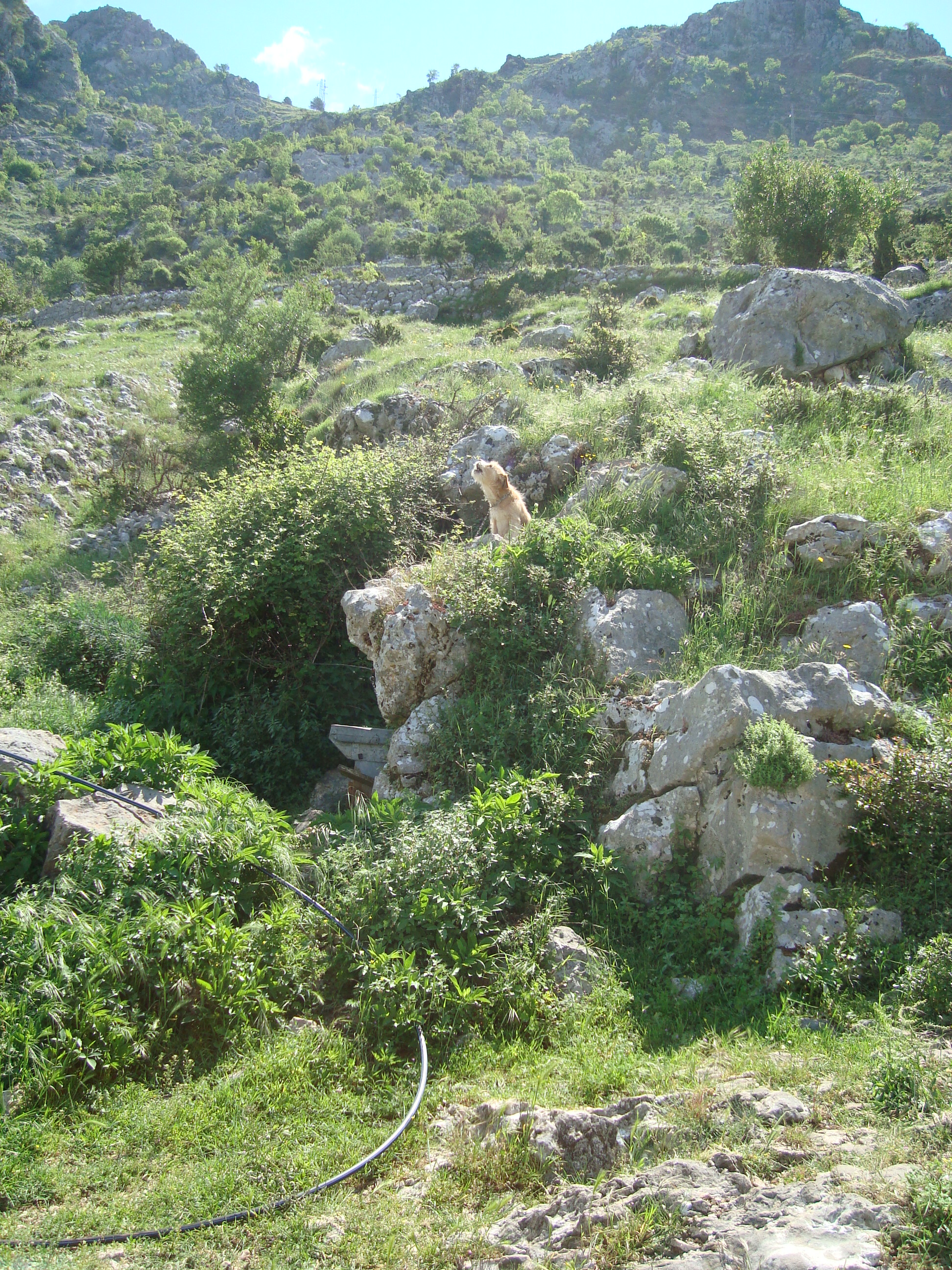
the poor little mutt was tied up for the whole day and growled meanly at me.
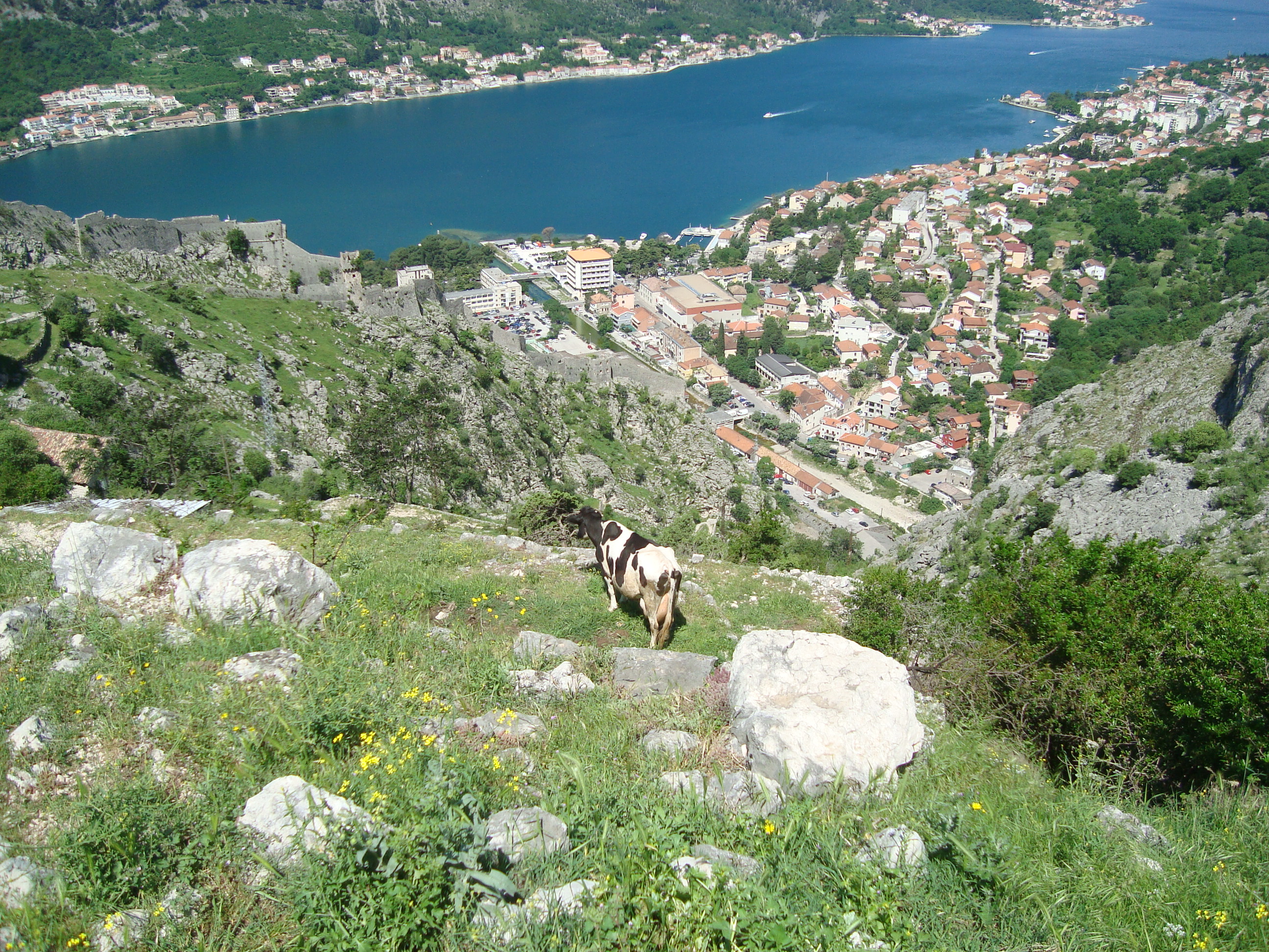
Followed by the lady’s cow:
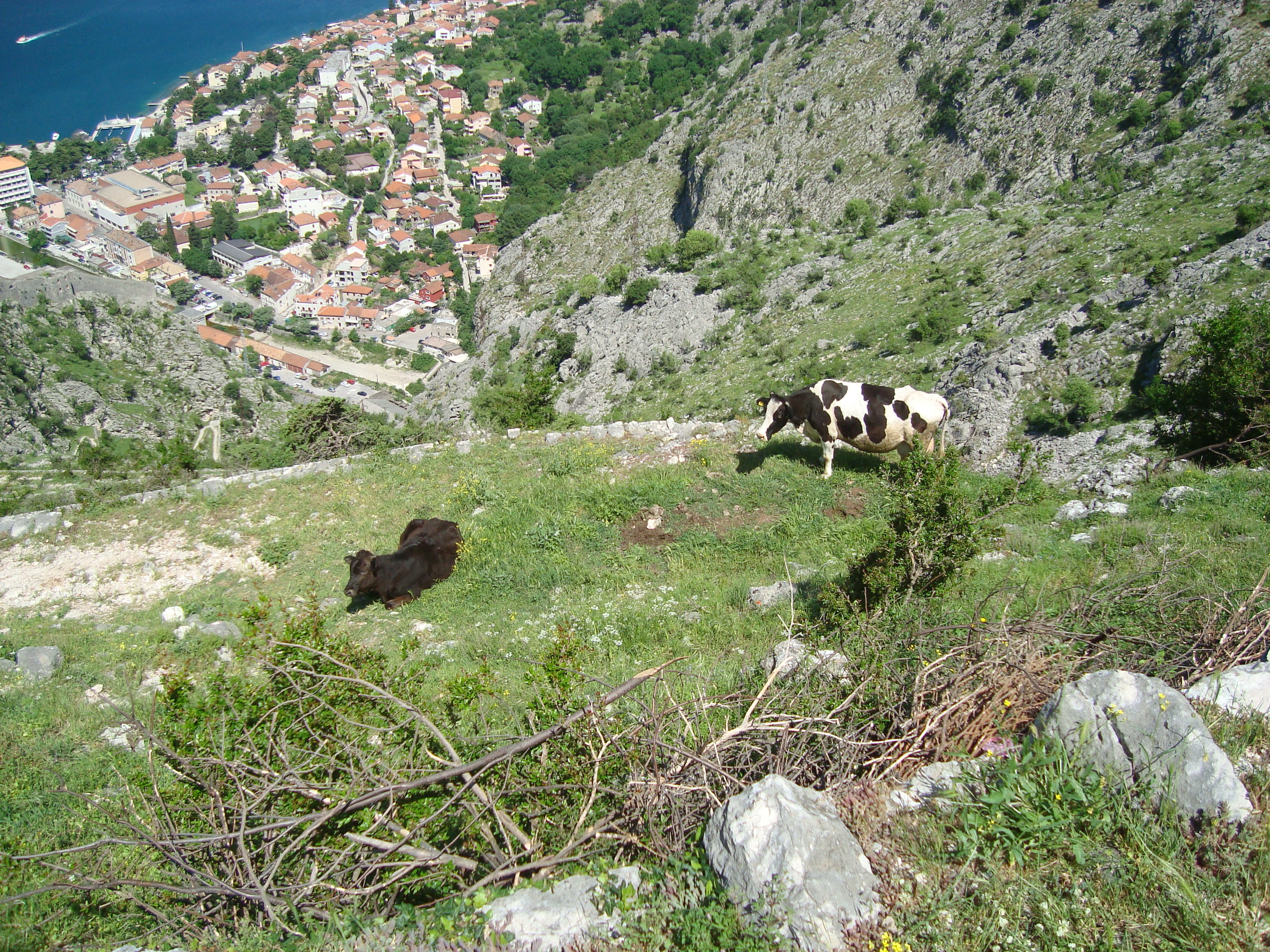
And the lady’s other cow:
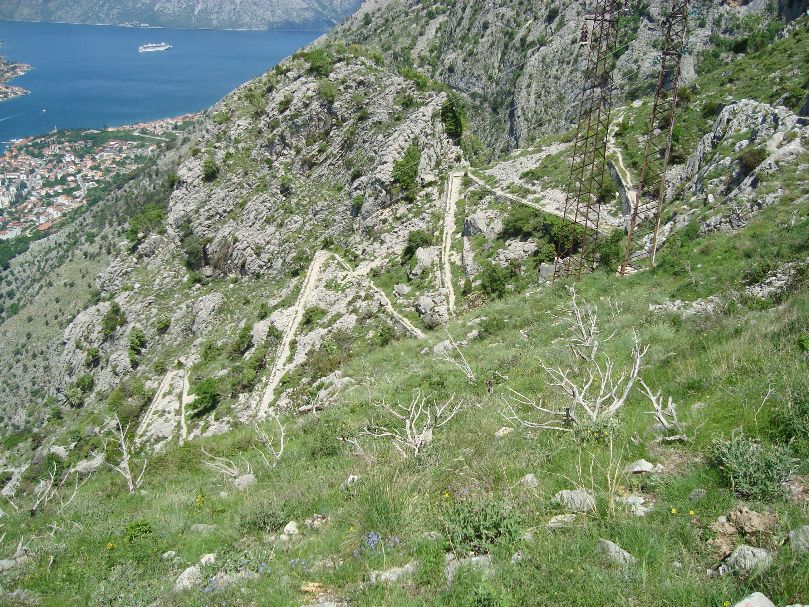
The rakija bar sits right next to the relentless zig zags that make up the first section of the path up the mountain. Just go up from here! (I promise you it’s only mildly mentally punishing going back and forth on all those zig zags):
Somewhere during the zig-zagging I realised that last night’s red wine cork was pressing into my kidney, both physically and figuratively – it was so tasty that I’d decided to polish off the entire bottle and put the cork in my backpack as a memento. Try the Vranac Plantaže if you’re in town, it’s delicious!
Eventually you’ll get to the end of those relentless zig zags after considering for a while and then climbing around a fence that blocks off the entire path. You’ll end up in a welcome, sparse pine forest covering a low peak.
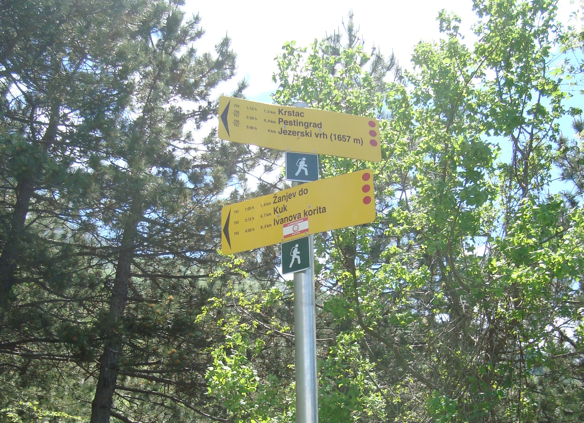
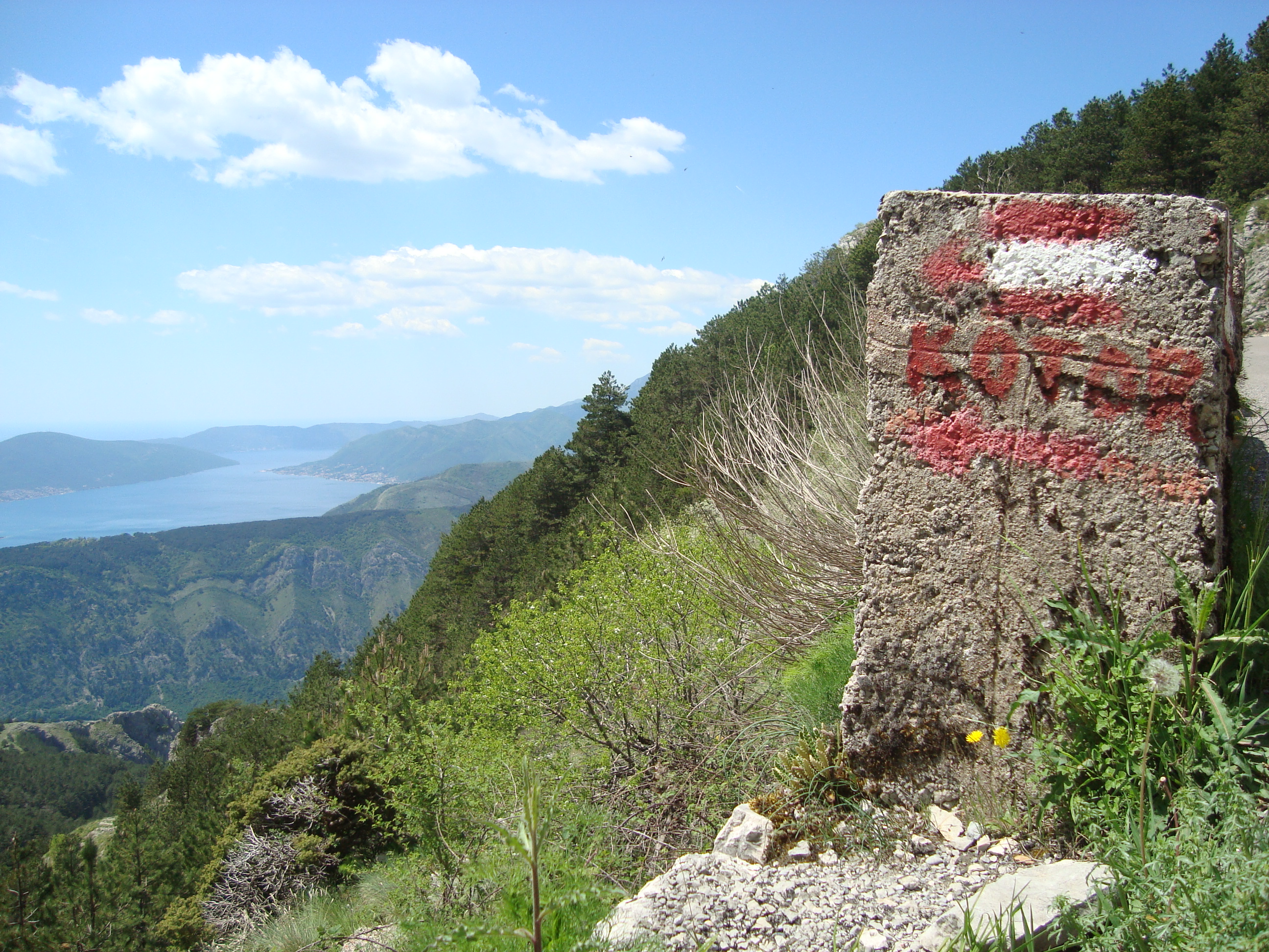
Continue round the peak and when you reach the sign listed with distances that seem to be wildly misaligned with their suggested walking times (believe me, in reality they are not), take the lower path, toward Krstac, Pestingrad, Jezerski Vhr:
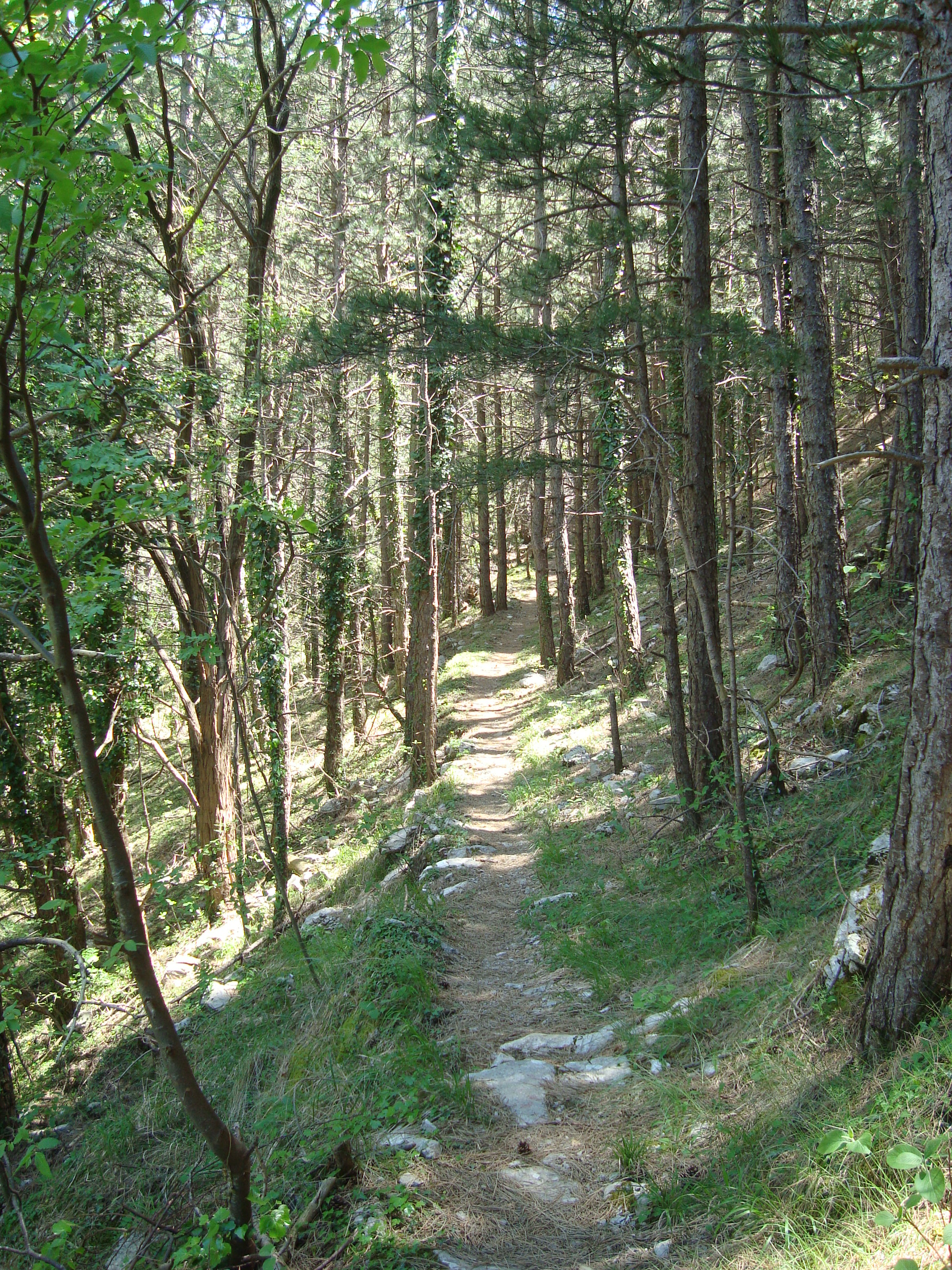
For a while after the sign, the path is idyllic and easy:
Avoid settling into a false sense of security though, because after the danger sign, things get a bit precarious.
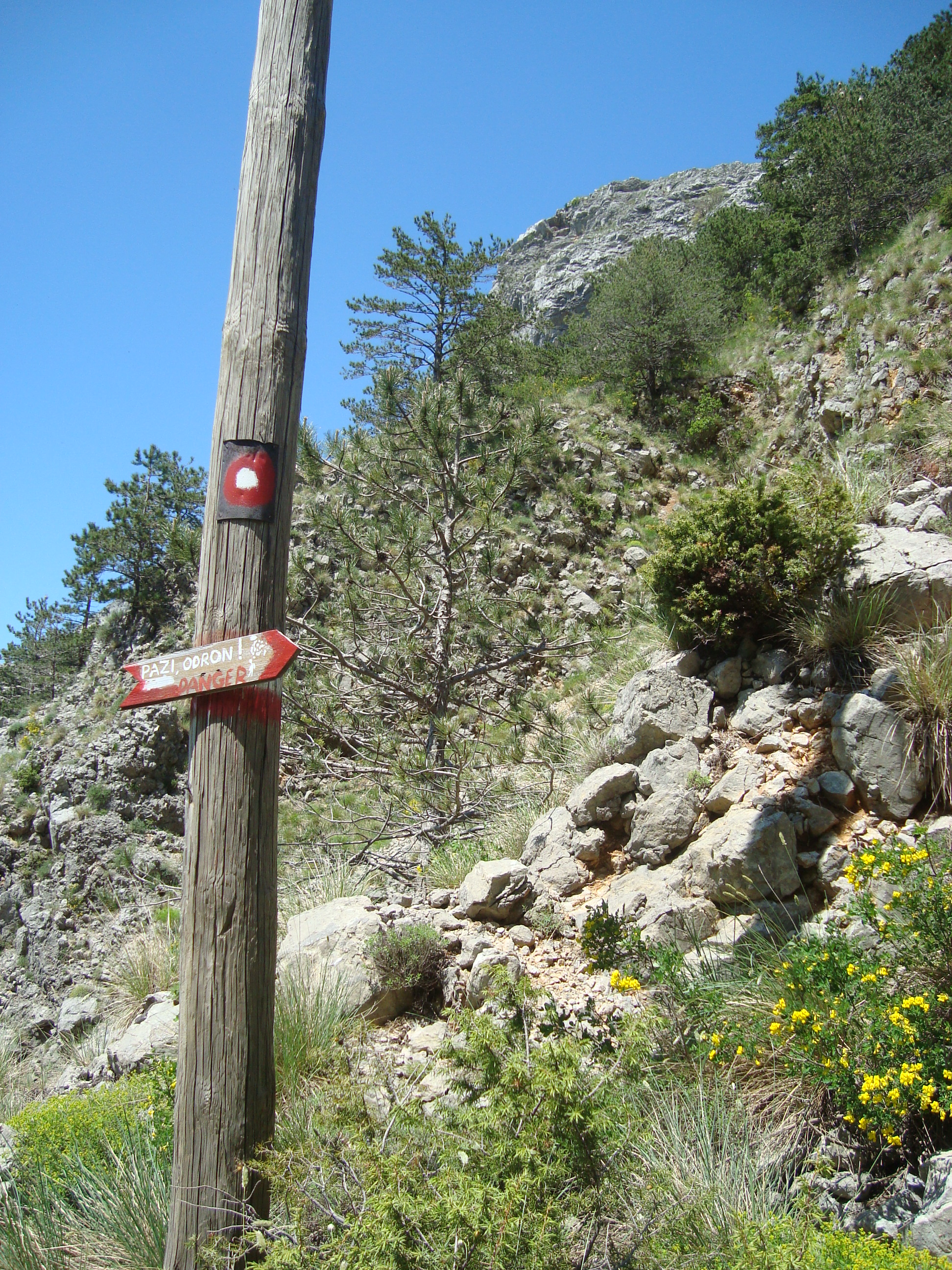
And indeed, after this sign it becomes very steep with loose rocks everywhere and some pretty sheer drops. A few times with my complaining knees and my fragile, height-boggled brain pleading with me to turn around and go back, I nearly decided to do just that.
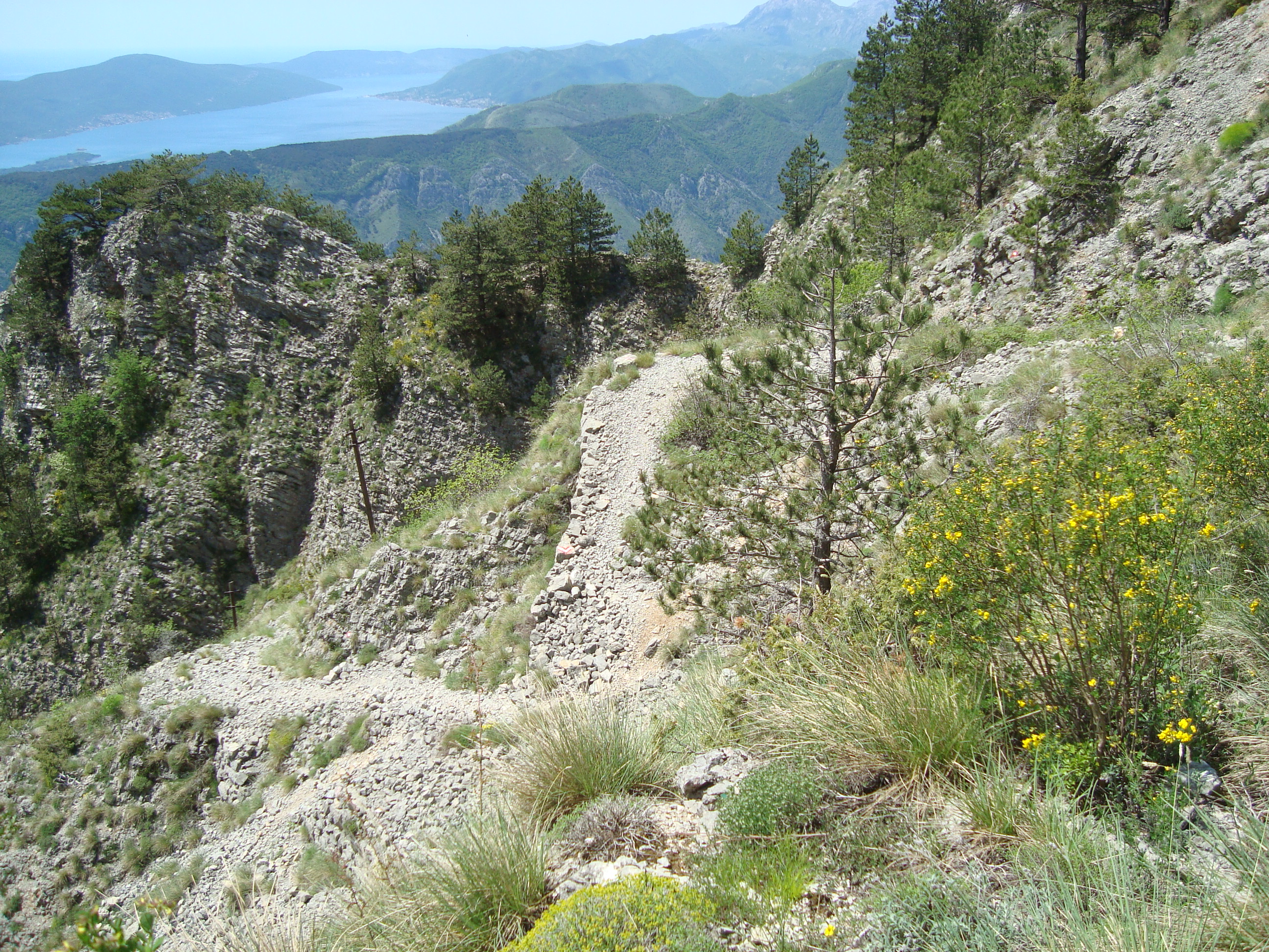
But I could sense the top, just there above me. I felt like I could see it. As everyone who hikes knows, as soon as you think the top of a hill is just there, the whole landscape rearranges itself Matrix-like and there’s inevitably still quite a haul ahead. Deceptive corners hide further steep climbs. New hills and hurdles pop up, seemingly out of nowhere. So I continued on past the death defying, narrow pathways until I reached the top… well as far as I was going anyway.
I sat for a while next to the Shitting-Your-Pants-The-Entire-Journey road and congratulated myself while watching tourist buses crawl dangerously around the tight corners and enjoyed the giddying, expansive views of the whole bay.
There are even more zig zags on the way back down because instead of going back through the fortress I took the rest of the mountain path down to the bottom where it meets with the North Gate of the old town. Incidentally if you are stingy and don’t want to pay the 3 euros to enter the fortress through the front door you can use this back path to get in for free.
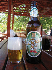
I romped back down the mountain, tired enough now not to bother with the rakija bar. A beer in the old town was really the only worthy reward for what was a pretty punishing hike.
Further info
Location: You can gain access to the path that leads up to the fortress from Trg Salate in the eastern part of the old town. It’s 3 euros to get in.
What to take:
- Water! I drank nearly 1.5 litres and I don’t normally drink much on hikes.
- Sunscreen, a hat and maybe even long sleeves if you are prone to sunburn. Most of the track is in direct sunlight and it can get pretty hot.
- Proper shoes – even if you are Australian, thongs (flip flops) will not cut it on this path.
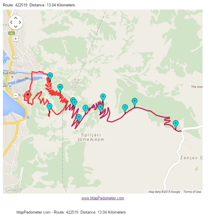
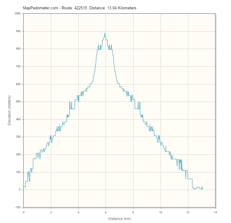
- Some lunch – it’s a comprehensive walk. The total distance was 13km and it took me 5.5 hours including time for a short stop for lunch and a look around the fortress.
Route Map and Elevation Graph: